everviz 数据可视化平台
everviz 数据可视化平台
everviz now lets you transform routes, boundaries, and locations into dynamic stories that move and evolve over time to reveal trends.
everviz is a cloud-based data visualization platform that helps users create visually appealing, interactive and customizable charts, maps, and other visuals. It provides a user-friendly interface that doesn't require any code or design skills, allowing users to quickly generate responsive visualizations with built-in support for accessibility. The platform provides the flexibility to embed these visualizations into web applications, or share them directly, and enables users to effectively engage with viewers across devices.
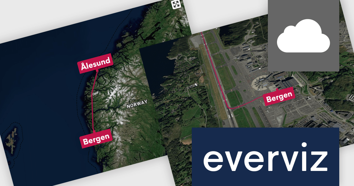
everviz has introduced file imports for animated maps, allowing developers to import GeoJSON, TopoJSON, KML, KMZ, and GPX files directly into their projects. This enhancement simplifies the integration of real-world geographic data into visualizations, enabling developers to create interactive and animated maps that represent routes, regions, and spatial patterns with greater accuracy. By removing the need for third-party GIS tools or manual data conversion, the feature increases efficiency and makes it easier to incorporate dynamic, data-driven maps into applications and reports.